Which Is Being Proposed? |
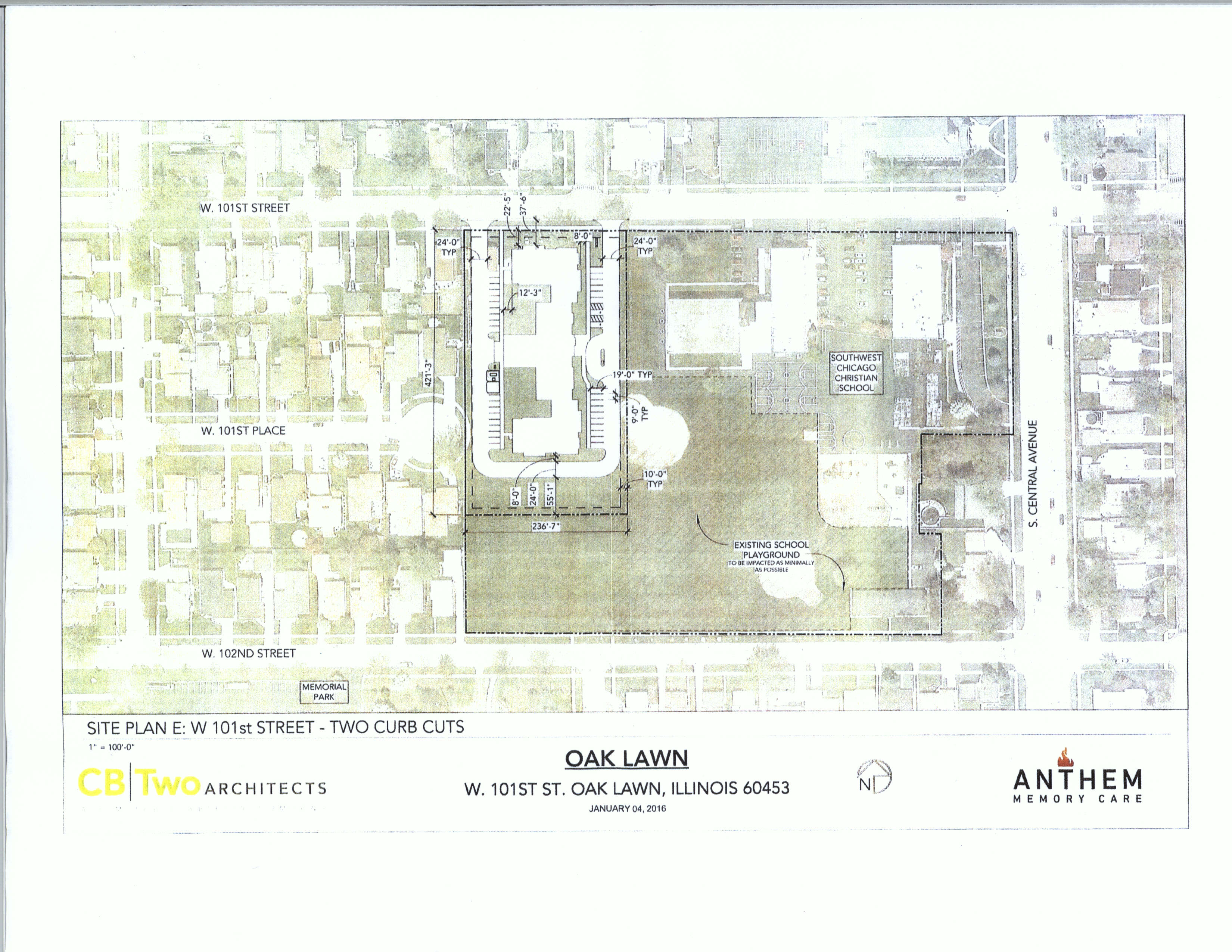
One particular drawing that was on display at the "fact-based" meeting fails to provide any measurements, which may not seem overly important until you compare it with another earlier version that does.
|
Missing Facts?
The lot dimensions on the drawing that includes the measurements are consistent with the measurements provided verbally at the "fact-based" meeting, which can be heard around the 28-minute mark of the audio recording posted on YouTube. Those stated dimensions were given as approximately 415 feet x 240 feet. The drawing that was distributed to those that attended the neighborhood meeting held on March 30, 2016 reflects measurements of 421.25 feet x 236.5833 feet when converted to decimal form.
(Source: https://www.youtube.com/watch?v=KS-529I80NE&feature=youtu.be)
(Source: https://www.youtube.com/watch?v=KS-529I80NE&feature=youtu.be)
|
|
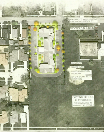
Yet somehow despite not drastically changing the overall lot dimensions, the more recent non-labeled drawing that was on display at the "fact-based" meeting is depicting a substantially smaller footprint for the proposed site. You can tell by just looking at the area landmarks that something is way off, but if you had not seen the earlier version you would likely not question anything.
Measurements for the latest non-labeled depiction can be estimated by using the Cook County Property Viewer tool or Google Maps. The result is a lot measuring approximately 360 feet x 210 feet, when using the Cook County Property Viewer tool. That creates a 75,600 square foot or 1.74 acre parcel, which is over a half acre smaller than the 2.28 acre that has been reported to date.
Did the plan change to incorporate a smaller building on a smaller lot as depicted in the drawing or is the drawing merely an extremely poor (mis)representation of the facts?
Perhaps it is merely a coincidence that this smaller footprint, at least is it as depicted in the drawing, is also located further away from the FEMA floodplain.
